Introduction
In this article we will begin a cycle of reviews of navigation software for Windows Mobile. In the previous article about GPS technology we have already touched on casual market of navigation devices, and wrote that, in our opinion, the most promising solutions will be built. And the most common among the last to date are the Windows Mobile-device.At this stage, many navigation applications. Most of them are produced by foreign companies. However, our developers are not standing still, periodically creating products that are comparable in quality with foreign counterparts, and sometimes surpassing them in some parameters. One such application is NAVITEL Navigator 3. Its founders were the creators of the infamous program RUSSA. However, except for software developers do not have anything to do with their previous offspring.
Installation and Activation
Purchase Navitel Navigator 3 for Pocket PC can be traditionally in several ways. The program is present in the range of a number of distribution networks is also available online ordering. In addition, Navitel Navigator 3 for Pocket PC can be found in a set of some communicators. Sam distribyutiv can be taken as from the enclosed disc and from the site. We recommend the second option, since in this case, you are guaranteed to get the latest, most current version of the program.
Then the fun begins. It would seem that complicated to run a program on your device and enter the registration data from the card. Because it is so by the registration or activation programs for most manufacturers. However, in our case is different. To activate the program in two ways. The first - directly on the device. In this case, when you first start the program will offer themselves to register. To do this in an empty box, you must enter the data from the card, then click on the "Get License Key". Communicator will be released on the Internet and download a text file called «NaviTel Activation Key.txt» (he will be in the system folder with the program), this key is generated based on device ID and registration card number. Thus, activation of individual programs for each device and tied to the hardware. It is worth noting that we have failed to register the program, access the Internet via ActiveSync. Nevertheless, through GPRS-channel all gone in seconds.
The second way of activation via the Web - www.navitel.su. It is necessary to perform all the same steps that we described earlier, only on a computer screen. Upon completion you will be prompted to download «NaviTel Activation Key.txt». This file must be placed in a folder with the program.
Such a system activation is unusual but not unique. Now, many manufacturers are compelled to go to the complication of the registration process in connection with the devastating incidence of so-called "broken" software.
However, for the average user used in Navitel Navigator 3 protection system also has some difficulties. Primarily they arise by replacing the unit. The company's website says that to re-register the program you need to write an email to technical support, which should indicate their activation data, name and phone number. The application is considered 2-3 days.
However, by registering the program, we are faced with another problem - the activation maps. It is a similar way, but only from a desktop computer and the Internet. In this case, each card is activated immediately to your program.After filling in numerous fields, you are offered to download the registration file to be placed in a folder with maps.
The need for registration cards I do not understand, because even I, a man ready for the complex process of activation, the data manipulation irritated and took quite a long time. However, it is worth noting that the company is aware of this issue, and, judging by the statements, it will be resolved soon.
Getting Started
It would seem that what may be preparing to work with navigation software? Launched by choosing a card and go. At least this way I acted, most well-known programs. But do not NAVITEL Navigator 3.To work correctly, the program is necessary to make several non-trivial action. The first index cards. To do this in the menu "View" select "Open an atlas, and it is an atlas rather than a map.

After several weeks of use the program I'm used to the fact that sometimes when too large an increase card was lost, leaving only the waypoints are displayed on a white background. It turned out that this problem could be solved immediately, just a little more carefully prepared a program to work. It was necessary only (the quote from the manual): "In order to display maps at different magnifications, you must install the squares of maps of the whole of Russia. You can download them here ... "After downloading the files should be placed in a folder with maps and again to indexing. For me, remains a mystery, which had prevented developers to immediately equip cards these mysterious "squares."
It is worth noting that no further manipulation of the settings of GPS-receiver is not required, it was immediately found the program and will not cause any problems.
In general, such a need for applications to work very annoying. And it is not clear why a program such as TomTom, iGO, Destinator, able to work without a preliminary index cards, and upload additional "boxes" and "Navitel Navigator - no. However, most likely, and this problem will be solved eventually, but it is now urgent, and it should not be discounted.
Maps and Navigation
Navitel Navigator 3.0, unlike most of its competitors, using maps of Western Tele Atlas, as a cartographic base took the development of the Federal Agency of Geodesy and Cartography of Russia (Roscartography).Beginning of the history of this structure can be considered March 15, 1919, when the Decree of People's Commissars was established Geodetic Administration (VSU). Precisely because of this administration, our country has reached a world level by the degree of topographic and geodetic scrutiny. His forces the entire territory of Russia will provide topographic maps in scale 1:25 000 - 1:1 000 000 and 25% - 1:10 000, with all cities and towns have a scale of 1:5 000, 1:2 000, and sometimes and larger. In addition, constantly being improved and updated these cards due to a previously created geodetic network.
Compare the accuracy and relevance of the foreign maps Tele Atlas and the Russian Roscartography pointless. The latter has many advantages, starting with what already has most of the cards in stock, ending with a refresh rate, which should be held regularly, as required in the interest of the state.For comparison, here are two screenshots of the same place in the first case we have a program that uses maps of Tele Atlas, in the second - card Navitel.
 |  |
At this stage, the list of available cards appear:
- Overview map of the whole of Russia
- Map of Moscow and Moscow region with routing
- Map of St. Petersburg and Leningrad Region with routing
- Map of Yekaterinburg and the surrounding area with routing
- Map of Kurgan Kurgan region and routing
- Map of Samara with routing
- Map of Tyumen with routing
- Map of Chelyabinsk routing
- Map of Novosibirsk and Novosibirsk region with routing
In the near future will be issued:
- Map of Belgorod routing
- Map of Voronezh routing
- Map of Ufa routing
- Map of Kazan with routing
- Map of the Vladimir region with routing
- Map of the Tver region with routing
- Map of Krasnodar and the Krasnodar Region with the routing
- Map of Stavropol and Stavropol Territory routing
- Map of Sochi with routing
- Map of Pyatigorsk routing
- Map of Omsk, with routing
- Map of Kemerovo routing
- Map of Krasnoyarsk Territory with routing
- Map of the Altai Krai and Altai R. routing
- Map of Ukraine.
Proceed directly to the navigation options. Start the program and waiting for the signal reception from satellites, we can see in front of a map of the area, which is at the moment.

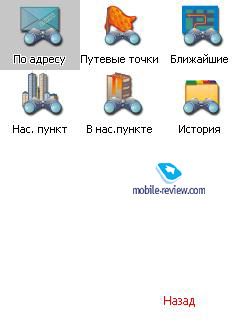
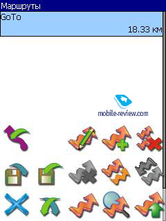
We list the basic navigation capabilities NAVITEL Navigator 3.
Track record. With this function you can record your route traversed. It's enough to activate it at the beginning of the movement on and off in the end. Then the track can be sent, for example, familiar. The first feature is useful for the city, where there are no reference points, and explain the way to a particular site comes almost on the fingers.
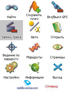
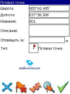
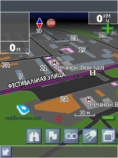
Download information about traffic jams. When installing the program on the PDA with GSM-module, you have the ability to download traffic information. It is compiled based on data from the agency SMIlink. The reliability of information provided to them: in Moscow - 95% of the city center within the TTC - 80%, TTC and the radial line - 70% on the remaining streets of the city - 50-70%.
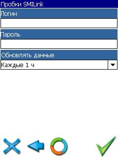
In order to obtain information about road conditions, you must connect tariff agency SMIlink "" free road ". For a small monthly fee - 200.9 rubles a month - you get a personal login and password. If you enter them in the menu "Jam SMIlink» and enable the setting "Use for a route, then a route will take into account traffic conditions, and will be offered as an optimal path with the least amount of congestion. It is worth mentioning that in my kit had invested two weeks of the demo account, it can be used free of charge to evaluate the effectiveness of this function. I found it useful and handling fee of 200 rubles - acceptable.
Findings and impressions
On his impressions of the program is not simple. At first acquaintance it leaves a lot of negative emotions associated with the first registration, and then installing cards. But over time, these moments are forgotten. What remains? Primarily, this is one of the best to date maps with excellent detail. The second - a reliable program that is compatible with all Windows Mobile-devices. The third - navigation system with online-updating of road conditions. Do not forget that the entire interface is completely Russified.It is worth saying a few words about competitors. If we talk about Russian foods, there is only one - navigation program AUTOSPUTNIK ", which is the successor Pocket GPS Pro 2. This product is comparable in value, the order of 100 - $ 110, and on opportunities. However, as a supplier of cards "AUTOSPUTNIK uses already familiar Tele Atlas. However, it is worth noting that in terms of ergonomics it an order of magnitude Navitel Navigator 3.0.
If you compare the product of Navitel with foreign counterparts, it surpasses them both in price and on the details and relevance of maps, but completely loses in terms of ease of use. Details on this topic will be covered in the next review of the navigation software.
It is important that now is a very dense work on the simplification of registration systems and the installation of cards. Also in the near future will be redesigned interface. And if all these changes will be adequate, then the program NAVITEL Navigator has all chances to become the best navigation products to Russia.